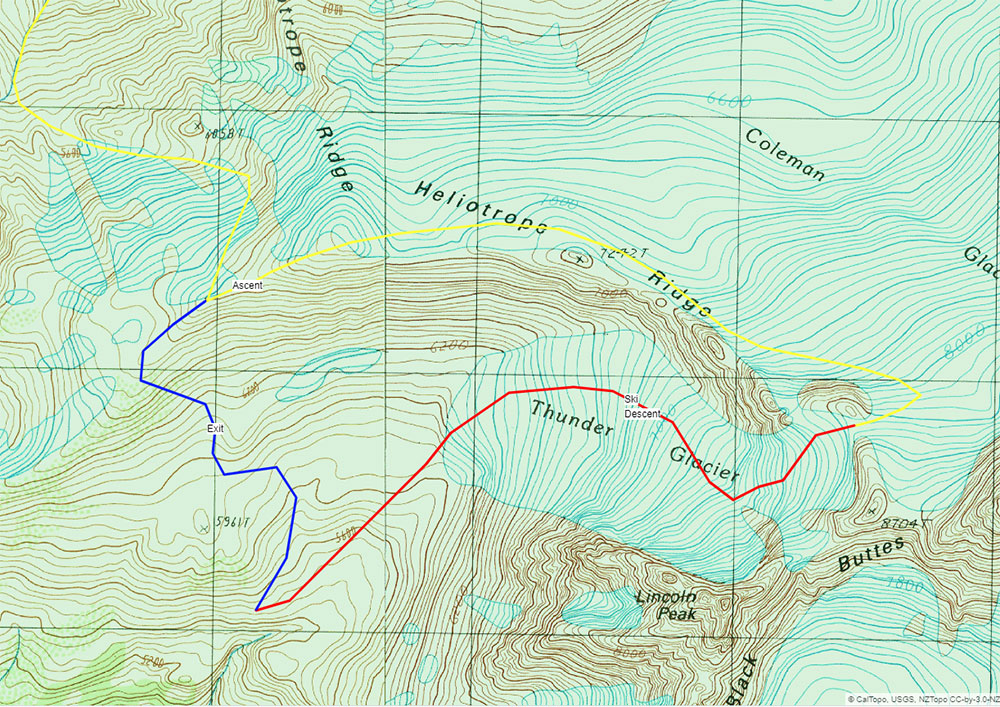
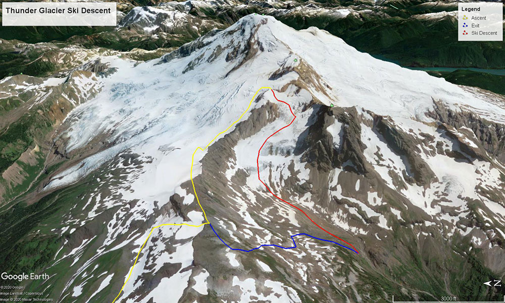
Thunder Glacier
Ski Descent
A Hidden Classic
We’re lucky to have Mount Baker as our namesake and main office. Complex, heavily glaciated, and wonderfully positioned in the North Cascades, Koma Kulshan stands at only 10,781 feet, yet radiates a BIG mountain impression. The mountain receives some of the largest snowfall totals in the world and hosts numerous classic ski mountaineering objectives. I’ve been exploring this topography for nearly four years and it continues to deliver amazing opportunities for adventure, such as skiing the Thunder Glacier.
The Thunder Glacier had been on my radar as a ski descent for several winters. It’s a striking line that’s often hidden while climbing the main routes. The Thunder Glacier is tucked between the jagged walls of Lincoln Peak and Heliotrope Ridge. Both flanks are characterized by crevasses and seracs, leaving a perfectly plumb fall line descent right down the middle. On March 15th 2020, as “normal” daily life was about to come to a screeching halt, we set off to snag what would be one of the last missions of our season.
Glacier Creek Road Access
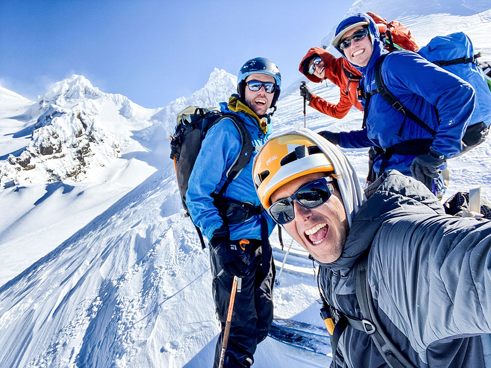
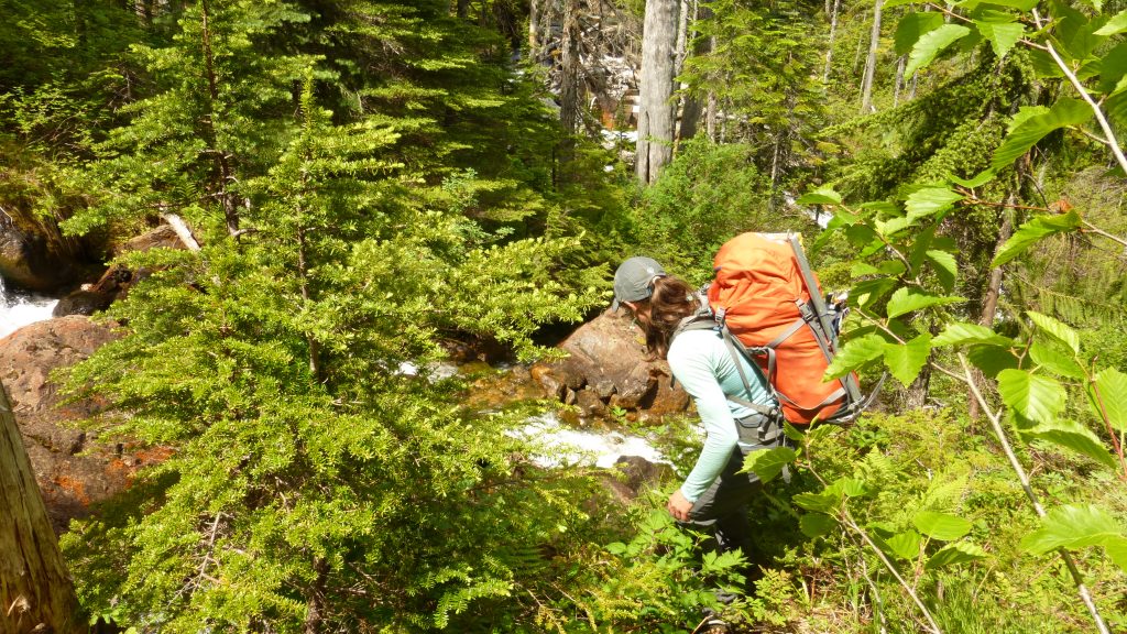
At 5:00 am the crew piled into my Tundra with snowmobiles in-toe. As we rolled out of Bellingham and down HWY 542, the excitement for the day started to build.I love these big days in the mountains. Forty-five minutes later, we found snowline on the Glacier Creek Road ◙. Five miles remained between us and the Heliotrop Trailhead ◙. Time to unload the sleds and figure out how to get six people up the road with two machines.
We had two options: we could shuttle and do two trips from truck to trailhead or we could double tow and get everyone up in one push. Shuttling would be easier on the snowmobiles and the legs; towing would save us an hour. I have a tendency to get a little over-stoked from time-to-time, especially when we have the opportunity to get the Baker Mountain Guides squad together on a rare sunny pow day. That and the fact that we were heading out for a big day made us decide to tow. A short 15 – 20-minute ride and we’d be on skis heading up the mountain. What could go wrong
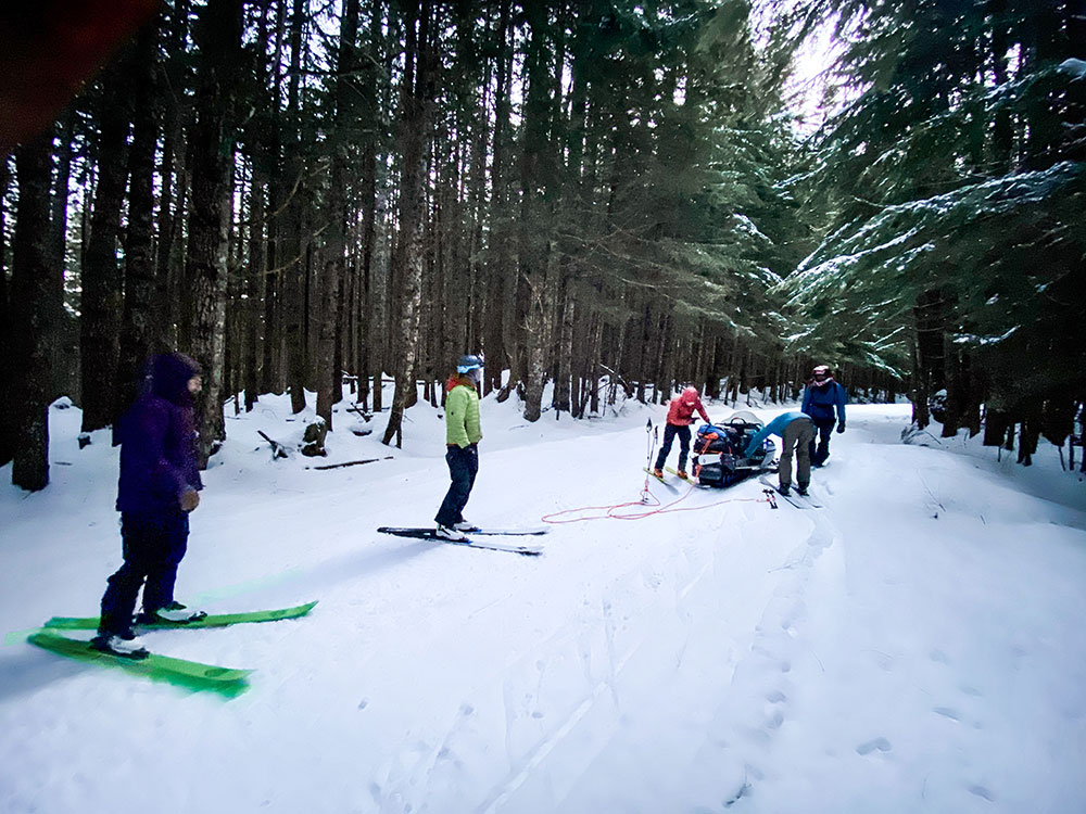
This was our first season with consistent access to snowmobiles, necessary toys to execute our new program: Twin Sisters Backcountry Skiing. In efforts to execute a smooth day of guiding on sleds, the past month was dedicated to, well, making mistakes. We learned how to get stuck, get unstuck, rig gear poorly, and rig gear properly. The devil is in the details and we still had a few lessons to learn.
The zone is popular amongst local snowmobilers and the road typically boasts a packed sled track. Packed roads require the use of scratchers. These little rods of metal scratch the firm snow, kicking up enough debris to keep the engine cool. Fueled by excitement, we overlooked these little buggers and took off before putting them down. Nearly halfway, both drivers smelled trouble, literally. The sleds were overheating. We stopped, packed the tracks with snow and waited roughly 20 minutes for things to cool down. The hot engine melted and warped one of the drive belts. With snowmobiles you just have to roll with the punches; they break, get stuck, overheat, it’s just the name of the game.
By 7:30 am we made it to the trailhead. Psyche levels were high.
Coleman Glacier Approach
We left the snowmobiles behind and started the 3000-foot ascent up Grouse Creek ◙ to gain Heliotrope Ridge ◙. The morning was cold and calm as we toured through the old-growth forest. At treeline, we got our first look at the upper mountain. We observed active wind transport off the ridgelines giving us some concern for the conditions to come. However, the protected slopes lower on the mountain harbored perfect cold smoke pow. We continued, knowing that no matter what happened, we’d enjoy some fantastic skiing.
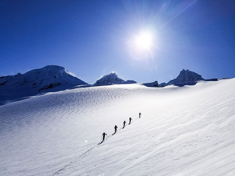
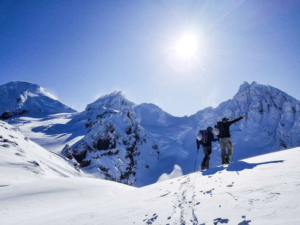
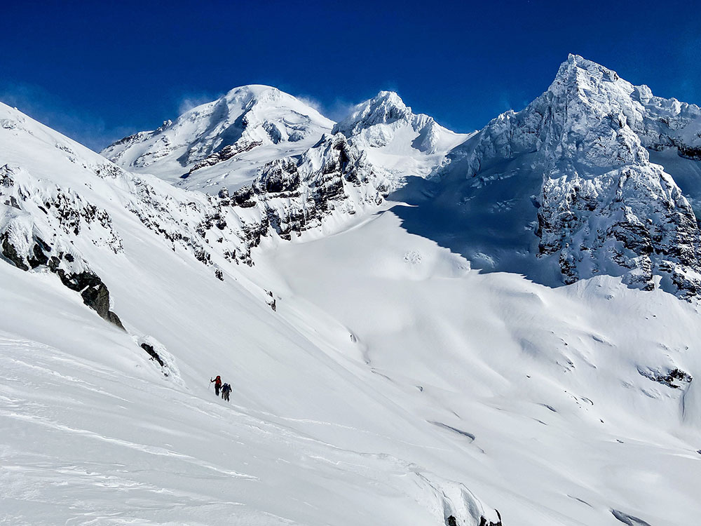
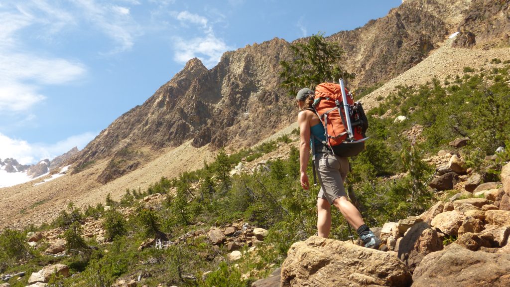
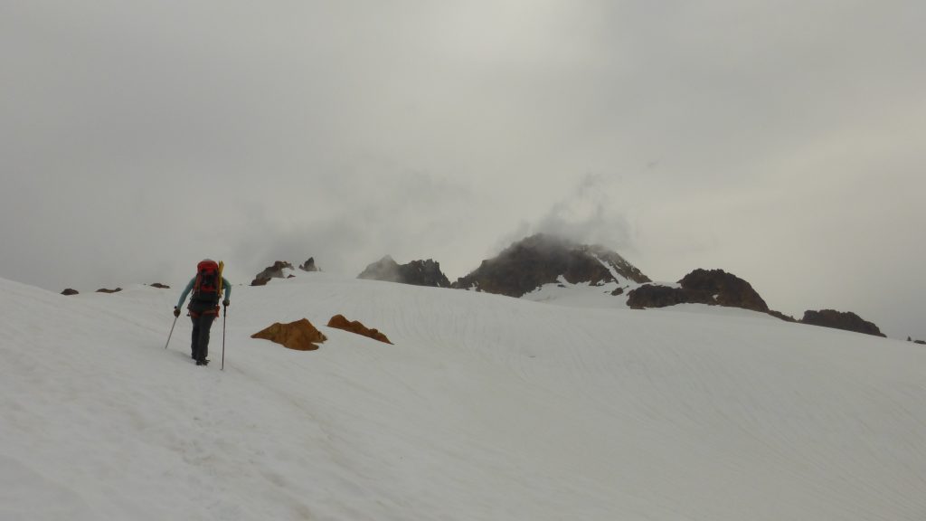
From the top of Heliotrope Ridge the views were amazing. To the south and west, we could see the Twin Sisters Range and the San Juan Islands. To the north, Canadian peaks littered the horizon. The Thunder Glacier was positioned directly in front of us with Mount Baker’s stoic presence looming in the background.
The south wind was stronger than we expected. Fortunately, the jagged spires of Lincoln Peak ◙ provided some protection for the route. Ski mountaineering is a game of margins. The deck was stacked in our favor with an experienced team, clear skies above, and the option to spin at any time. After some deliberation, we decided to continue.
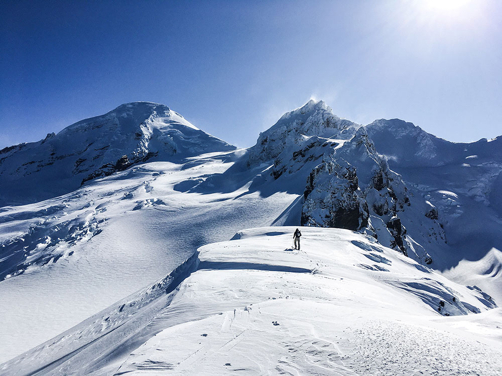
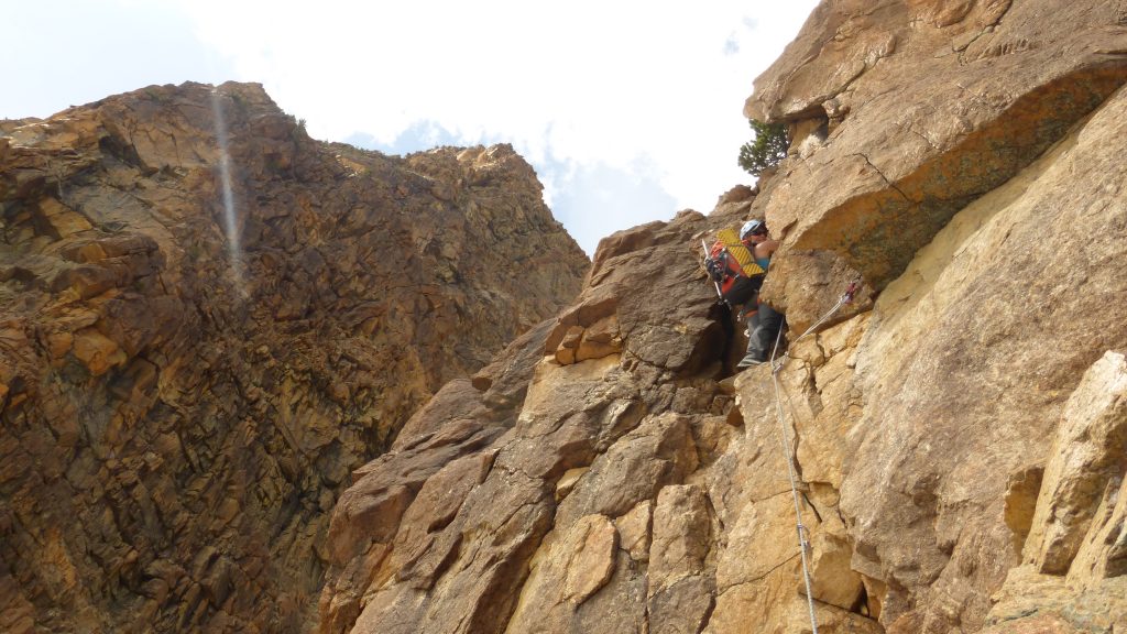
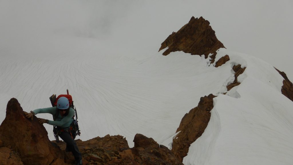
We dropped onto the Football Field ◙, a distinct feature on the Coleman Glacier ◙. Here, we donned harnesses and crevasse rescue gear. Another 1000 feet of climbing brought us to the base of the impressive North Face of Colfax Peak ◙. From here the route takes a sharp right turn off the Coleman for the final push to the top of the Thunder Glacier.
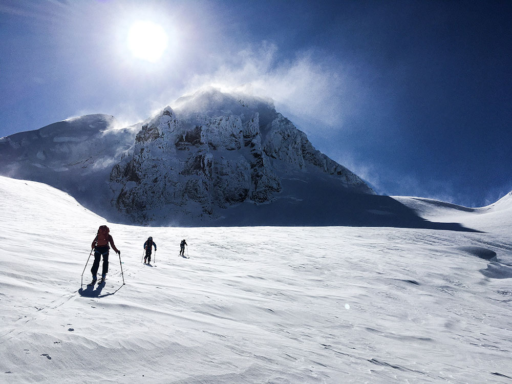
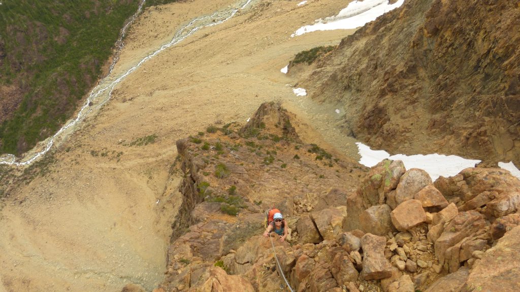
The winds were gusting up to 40 mph with sustained speeds in the 20’s as we crested over the saddle. When we peered down the other side things didn’t add up. We had over-shot the Thunder Glacier by a hundred feet and found ourselves looking out over the Deming Glacier ◙. A short five-minute downward traverse would lead us to the upper headwall of the Thunder Glacier and the proper start of the descent.
Thunder Glacier Ski Descent
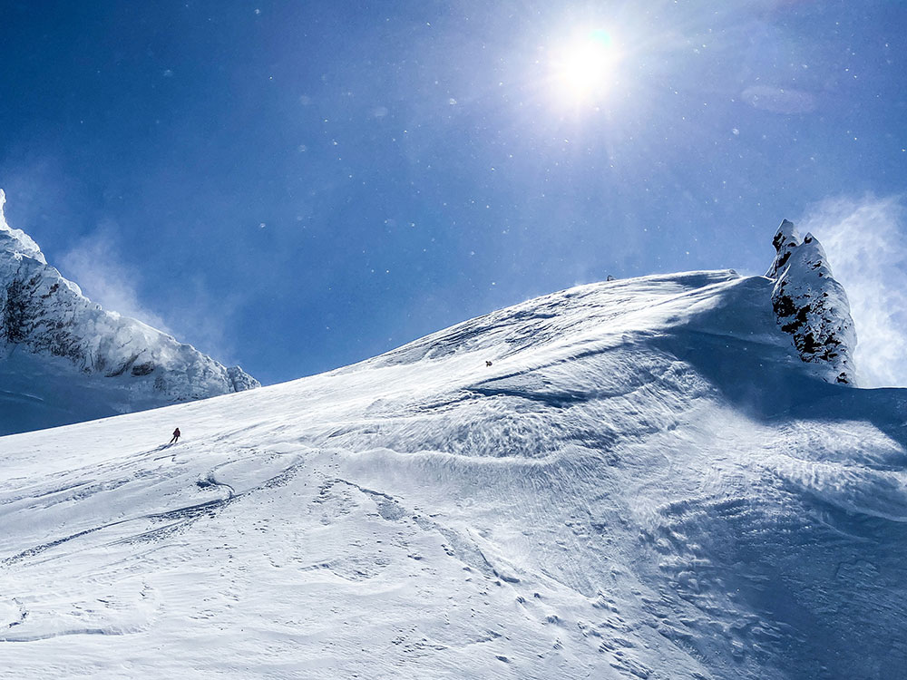
12:30 pm. Standing on top of the route it was clear that we needed to avoid the Thunder Glacier’s upper headwall. Excited and nervous, we weighed our options. The snow conditions just weren’t right for terrain that steep. To maintain our margin for error, we skied down the ridge to a saddle 500 feet below. This allowed us to take advantage of a low angle entrance onto the Thunder Glacier.
The skiing on the ridge was pretty bad. Variable and wind affected snow made for an exciting start to the descent. There was still hope that we would find better conditions lower down where the snow was protected from the strongest winds. As soon as we dropped off the saddle and onto the Thunder Glacier, the snow conditions improved. Our smiles grew large in anticipation of the turns to come.
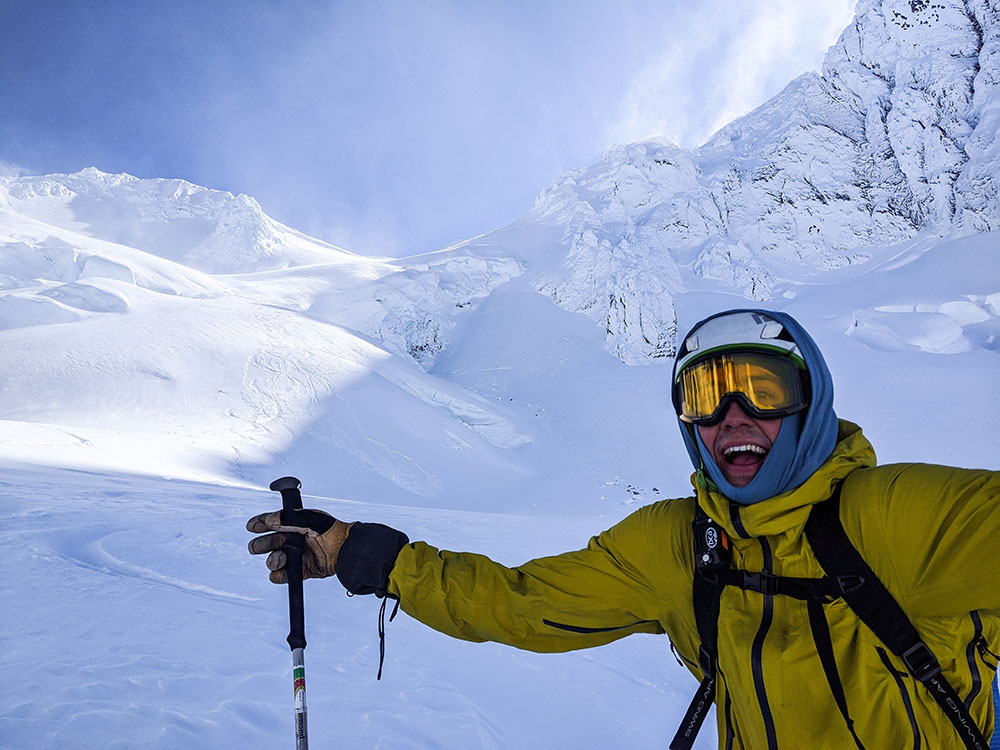
We skied short pitches through some lower angle terrain, feeling out the conditions. As we approached a steeper and more broken section of the Thunder Glacier, a small, shallow wind slab popped on a steep convexity and ran down into a large crevasse. We set up for a long pitch of skiing through the crux of the route. We descended one at a time. It skied like a dream; beautiful boot-top pow down a 35-degree apron in a wild position. Like I said before, I love these big days in the mountains.
Everyone relaxed a bit as we paused below the crux to catch our breath and take it all in. Finally, we continued down the remaining 1,400 vertical feet of nearly perfect, untouched powder only stopping to look back in disbelief at the stunning terrain. For the majority of the line, we were in the shadow of Lincoln Peak. Near the bottom, we popped out into the sun and stopped for a much-needed break to refuel. Looking back at the Thunder Glacier we noticed that almost all of our tracks were gone. The wind quickly reset the landscape and it was as if we were never there. The impermanence of it all – the tracks, our presence – it was perfect.
Before long it was time to pack up and start our final climb of the day. The descent drops you into another basin, leaving a mean 1,200-foot climb back to the top of Grouse Creek. Despite the wind and fatigue, the team made quick work of the climb, fueled by accomplishment. Soon enough, we were transitioning for another 3,000 feet of powder back to the snowmobiles.
Thunder Glacier Route Profile:
- Total Distance – 8.5 Miles
- Trailhead Elevation – 3650 feet
- Top of Route – 8570 feet
- Elevation Gain – 6100 feet
- Thunder Glacier Descent – 3070 feet
The Devil You Know – Green Creek Traverse
My husband is a mountain guide and a business owner, John Minier of Baker Mountain Guides to be exact. He typically works weekends and every hour of every day when he is home. I work a normal 9-5 Monday-Friday job. We rarely have the same days off. So when the opportunity presented itself for both of us to have two consecutive days off in a row, we jumped on it, even though John had just come off a trip that previous night and was exhausted. This is how most stories that don’t have the fairy tale ending start.
The Twin Sisters Range has long held a soft spot in my heart. Close to home, virtually devoid of humans, and largely wild and untamed. For several years now, we have been venturing into this area. This year we wanted to try to complete a traverse of the Green Creek Glacier, linking up multiple peaks along the way. It’s not a hard or long traverse. It can be done in less than two days, presuming you have the right weather.
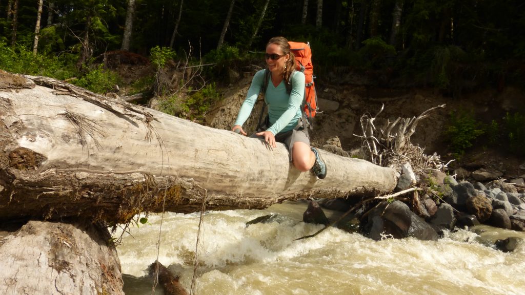
Our favorite way to access the area is via the Elbow Lake Trail from the Middle Fork of the Nooksack. At only 45 minutes from our door, it’s the closest access for these kinds of adventures, plus you get an AWESOME bushwhack through neck deep, unbelievably dense blueberry bushes. As the crow flies the bushwhack is a mile or less, but it sure does feel a lot longer when all you can see is the blueberry branch in front of you, hour after hour. What keeps you going is the occasional view of the valley ahead.
We got a late start, were on the trail around 11am, and at the base of the Green Creek Arête around 130pm. After some excellent scrambling and low 5th class climbing up the Arête, we topped out, pleased to find that the loose talus that dominates the area was still covered in snow. Both John and I were also grateful that some afternoon clouds had moved in and cooled the solar cooker that we were currently walking through. However, the clouds quickly turned into more than just shade. By the time we reached the base of the South Twin it was raining, not hard per se, but constant. We continued up the South Twin Sister in the rain, through some of the most fun scrambling I’ve done in the range yet. We topped out around 630pm, hoping to bivy on the summit. The view to the west was a black wall of water. Thanks NOAA.
For those of you who live in the Pacific Northwest, this is a more common experience than one would like. NOAA will call for clear sunny skies and what you’ll actually get is rain. That’s all well and good if you have the right gear for it. We however did not. We had planned on going fast and light. We were going to sleep under the stars sans tent or hardshell jackets, and in my case my NeoAir sleeping pad.
We poked around the summit of the South Twin Sister for a few minutes and pondered just going for it. If we kept moving, we could be over Jaw’s Tooth and Skookum before dark and we could just keep going until the storm (hopefully) passed. As John so keenly stated though, do you take the devil you know or the devil you don’t? The devil we knew involved scrambling back down the South Twin Sister, and rappelling and scrambling down the Green Creek Arête…on wet rock. Then there was the walk down the Field of Dreams – a 1000 vertical foot talus slope sometimes covered in sand and dirt. It’s a total disaster as far as walking is concerned. Many a people have lost some skin here. None of the rocks actually fit together, so pretty much everything you step on moves, no matter what size the rock. I’ve spent a lot of time on the Field of Dreams from my other trips into the range, so I have a sort of kindred relationship with the hellish slope. We chose the devil we knew.
We debated pushing out to the car that night. It was already after 9pm and we still had some awesome bushwhacking to do. Instead, we opted to camp in the basin at what I lovingly call “The Spa.” I’d been there before on a previous altered mission and luckily was able to find it again. It’s this nice camp spot in the bottom of the basin with two springs of fresh running water, and awesome sandy bivy spots amongst huge boulders. One of them was overhanging just enough to protect us from the rain. Unfortunately I had chosen not to bring my NeoAir sleeping pad. John, being the gentleman that he is offered me his. However, being the stubborn woman I am, I declined, purporting that I needed to learn my lesson.
We woke up early (John well rested and me exhausted from a rough night on the dirt) and stopped at the Refugio for a scone and coffee. We were home by 1030am. John and I were both a bit disheartened because the weather that morning was perfect, and we have very much wanted to complete the traverse. Sometimes in those moments when you make the choice to turn around you forget the awesome journey that brought you to where you were. We had perfect weather the entire way in and made it to the top of the South Twin Sister, which neither of us had done before. We had a wonderful night out in one of the most beautiful basins in the area and we made it out safely. We ended up grateful for the experience despite not being able to complete the objective. For us, everything is a work-life balance, and the balance is tricky. The scale seems to tip to the work side more often than not. We ended up with the best of both worlds this weekend. We got home early and were able to spend the evening on the river with our pup Tatlow playing fetch and chasing bunny rabbits!
And besides, if we have completed the entire traverse, what would we do next year?
Never Miss A Post
Get blog updates sent to your inbox.